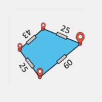
Easy Area is the simplest and most accurate land area measurement app to measure area, distance, and perimeter using GPS, Maps, or Photos. Whether you're a farmer measuring field size, a landowner checking plot boundaries, or a professional doing land survey, Easy Area gives you precise area calculation and distance measurement in just a few taps. TWO WAYS TO MEASURE Draw on Map (GPS Area Measurement) Search any location or use GPS to find your land. Place points along the boundary to measure land area, distance, and perimeter instantly. Draw on Photo (Image Measurement Tool) Import a photo, map, or survey plan. Draw over it, set scale using a known distance, and calculate area and distance accurately. POWERFUL FEATURES Accurate GPS land area measurement using coordinate and spherical geometry Distance measurement tool with point-to-point line display Manual distance input for precise corrections Multiple layers to measure multiple plots Save, load and organize measurements Share land area links easily Divide land into multiple plots (area splitting) GPS walking mode for field measurement Custom units support ALL THE UNITS YOU NEED Supports Imperial, Metric, and major Indian land measurement units like Bigha, Biswa, Guntha, Marla, Cent, Acre, Hectare, Ground, Perch, and more. Built-in unit converter lets you switch between units instantly. EASY TO USE Tap to add points, drag to adjust Double tap to insert new points Pinch to zoom and navigate Clean, simple interface Easy Area is built for real-world land measurement, area calculation, and distance measurement, whether you are on-site or at your desk. Terms of Use: https://www.apple.com/legal/internet-services/itunes/dev/stdeula/