Touch GIS

Touch GIS

By TouchGIS

  • Category: Productivity
  • Release Date: 2019-11-04
  • Current Version: 1.5.8
  • Adult Rating: 4+
  • File Size: 42.74 MB
  • Developer: TouchGIS
  • Compatibility: Requires iOS 15.6 or later.
Score: 3.75
3.75
From 24 Ratings

Description

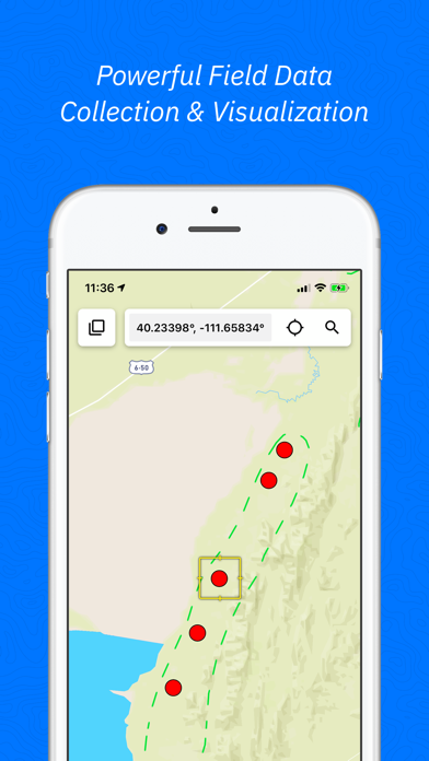
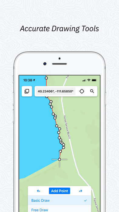
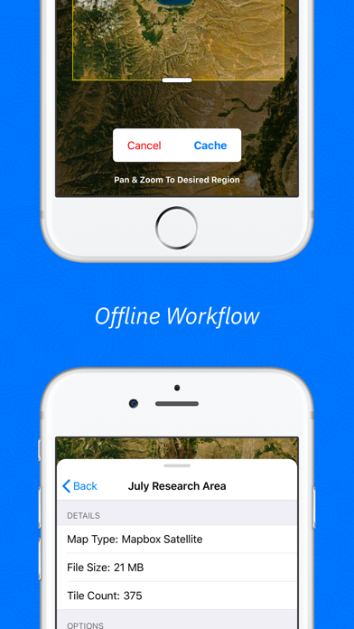
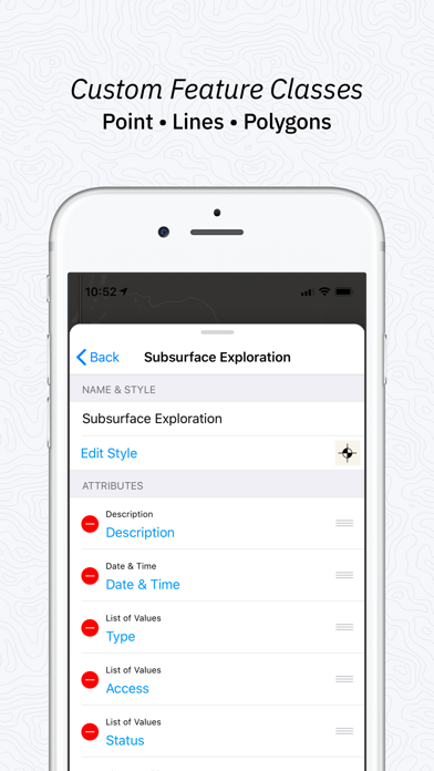
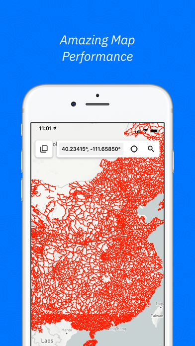
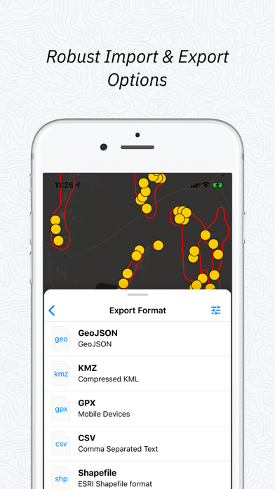
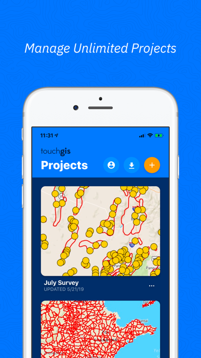
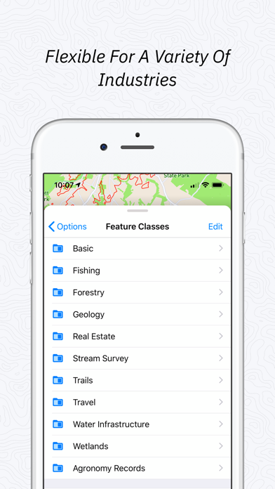
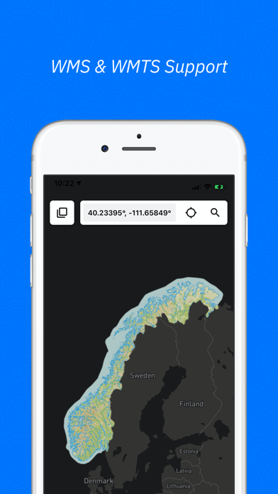
Touch GIS is a professional-grade field data collection and visualization tool powering advanced, intuitive, and flexible mapping. Powerful mobile devices are transforming how we work in the field. Touch GIS takes full advantage of these devices to make field data collection and mapping easier than ever before. Join thousands of professionals utilizing Touch GIS to amplify their work in geological mapping, ecological mapping, mineral exploration, residential and commercial development, and more. FEATURES - Intuitive Interface - Offline Capabilities - Map Caching - Robust File Support - Customizable Attribute Forms - Point, Line, Polygon, and Circle Features - Custom Feature Classes - Preloaded Feature Class Templates - WMS/WMTS Support - Raster Image Support FILE TYPES SUPPORTED - Shapefile - KML/KMZ - GeoJSON - GPX - CSV (Export) - World File - Geotiff CUSTOM FORMS - Description - Date & Time - Photo - List Of Values - Checkbox - Address - Number - Website - Phone Number PRELOADED FEATURE CLASSES - Forestry - Geology - Real Estate - Stream Surveys - Water Infrastructure - Wetlands - Create Your Own! Terms of Service: https://www.touchgis.app/terms-of-service Privacy Policy: https://www.touchgis.app/privacy

Screenshots

Reviews

  • Help

    1
    By Jingle124456789
    I’ve reached out to the developers and I get no response. How do I send files where my clients can actually view them and not just see code or see can not open?
  • Can’t export data anymore

    2
    By BrennaGabrielle
    I have been a fan of these apps, upgrading to the newest versions and although there are sometimes glitches I’ve never had a complaint until now. I no longer have the ability to export project points by CSV as of a few weeks ago. This has stopped my whole teams work progress right in its tracks. None of us can use it now. I can appreciate that this problem may eventually be fixed, but it’s hard to rely on a program that could have such a crucial issue for so long. We have a lot of jobs to map and now we are currently looking for a new program.
  • Powerful but user friendly

    5
    By Jdubya6655058
    Latest updates have been great!
  • Excellent product

    5
    By labasketball
    Very accurate, perfect for iPad.
  • So close…

    2
    By NV geo mapper
    I have been using this app in the field for about two years to make geologic maps. It had a lot of promise 2 years ago and the developers were available for bug fixes and improvement. The app is very powerful, and captures many of my field GIS needs. It has now been 1 year since they updated anything and they seem to no longer reply to service questions. Sadly it appears to be another unsupported zombie app. There are several bugs that are real issues with some of the functionality. I may continue to use it in the field but with limited capacity to avoid the bugs and issues. Its a shame because they were so close to building an ideal geologic mapping platform that we could roll out with colleagues and students. So if you are contemplating diving in I’ll just say that it still does many things well but there are some pretty serious bugs and apparently no prospect for improvement. However if you see substantial updates in the version history it might signal that the developers are actually reengaged with keeping this thing alive and viable. I hope they see these reviews and actually update Touch.
  • Very powerful app but.

    4
    By Hunter4622
    I commonly use arcGIS in my pc but for ipad TouchGIS app is extraordinary and it has no equal but i wish from the developers to add search in UTM units. Thank you and i will be grateful.
  • Intuitive and fast - but sync issues and lack of support

    3
    By Not Stan
    My mapping group has been testing touch GIS as a digital geological mapping software for mineral exploration. Creating attribute tables is a breeze - very intuitive. It’s easy to add pick lists, barcode scanning for samples, photo fields etc. Drawing tools are also the best of the various platforms that I’ve tested. The integration of structural attitude collector similar to FieldMove is great, and is what convinced my company to try touch GIS this year. Unfortunately it only records planar data and not lineations. This is the closest approximation to mapping on paper that I have ever used. The additional ability to collect and record sample data and photos is excellent. However, the data has to be exportable in industry standard formats to be brought into enterprise-level GIS (ESRI or MapInfo), or it ultimately can’t be used. Touch GIS offers several export options including a lossless proprietary file format that is convenient for daily backup, ESRI shapefiles, .kmz, .csv, and geojson. However, several of these exporters have glitches: we have found that once a map project reaches around 60mb in size, the ESRI shapefile exporter breaks. Carriage returns in your notes may cause additional junk entries in a .csv, corrupting the file. Importing georefferenced photos has been a problem. I have emailed support several times but never received a response. Several of these issues are probably fairly simple fixes, or they could recommend workarounds. I’m sure the development team is very busy, but without some level of tech support, users are going to be forced to retreat from this very promising software and go back to less friendly alternatives that can sync seamlessly with ARC or MI. Hey guys! Please get back to me!
  • Adequate

    3
    By Giacometti.
    Does what it promises. However, I am not a big fan of annual renewals which is about the same as their one time purchase predecessor GIS pro. It is a wonderful field- friendly app. To make the best use of its features, presetting attribute fields is essential. Touch GIS could use fields that record coordinates for easy export.
  • Crashes

    1
    By plkfsrbfsfn
    Cannot handle large databases. The app gets stuck and will ‘auto-close’ itself immediately after opening the project. Only remedy is to delete the project and start again. This type of app is for people who collect large amounts of IMPORTANT data, and this app is unable to preform this requirement without crashing and losing data/days of work. Make your app function correctly before you put a ridiculous price tag on it.
  • Intuitive, extremely useful

    5
    By 99Perspiration
    Excellent tool

keyboard_arrow_up